Dzerbene (16/34)

Home  /  Airfields  /  Current Page
×General

Former agricultural airfield with beautiful surroundings, located between Dzerbene and Taurene, surrounded by many lakes. Runway seems usable, however bushes around the airfield can make the approach quite challenging.

Effectivity: 2017-06-19

Location: 2 km S of Dzerbene town
Get Directions →

+Details

Status: Uncertified

Condition: Average

Ownership: Unknown

+Runway

Direction: 16/34

Dimensions: 400x20m

Surface: Asphalt

Elevation: 199m / 652ft

+Obstacles

Approach: Forest and road 160m from THR RWY34; bushes 150m from THR RWY16. Before any landing attempt make sure your climb performance is sufficient.

Airfield: Football fields between the RWY and apron.

+Other

Radio frequency: 123.95 MHz

Fuel availability: NIL

To see: Lakes; Dzerbene castle; Vecpiebalga

+Gallery
+Meta

Posted: July 6, 2013

Author:

Category: Airfields, Usable airfields

+1 Comment
  1. Gvido says:

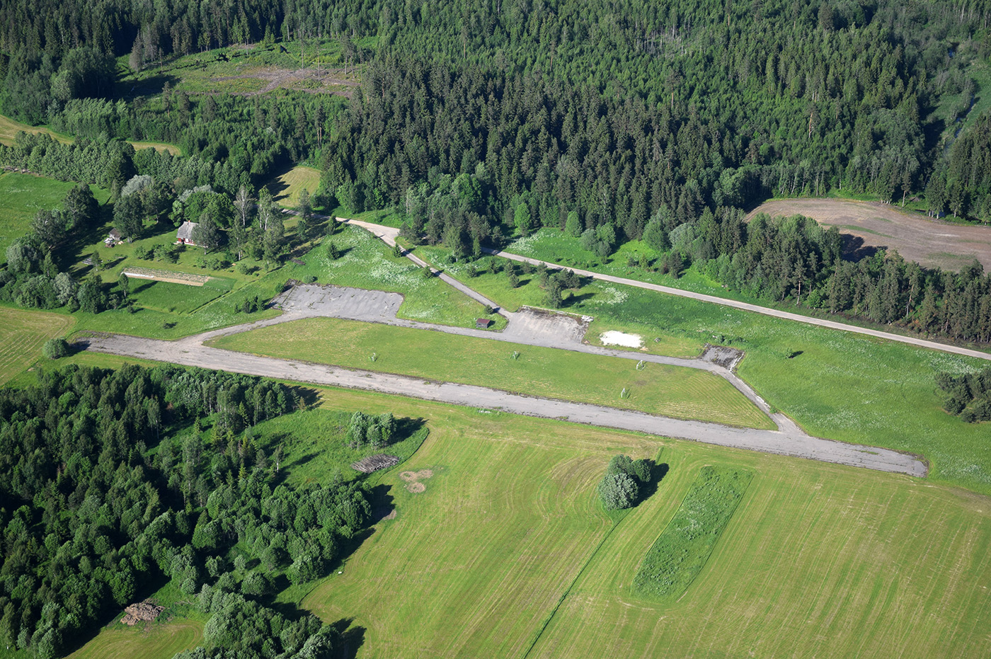
    Šis lidlauks biežāk tiek dēvēts par Taurenes lidlauku (sk. dažādos avotos tīmeklī).

Leave a Reply to Gvido