Gaujiena (18/36)

Home  /  Airfields  /  Current Page
×General

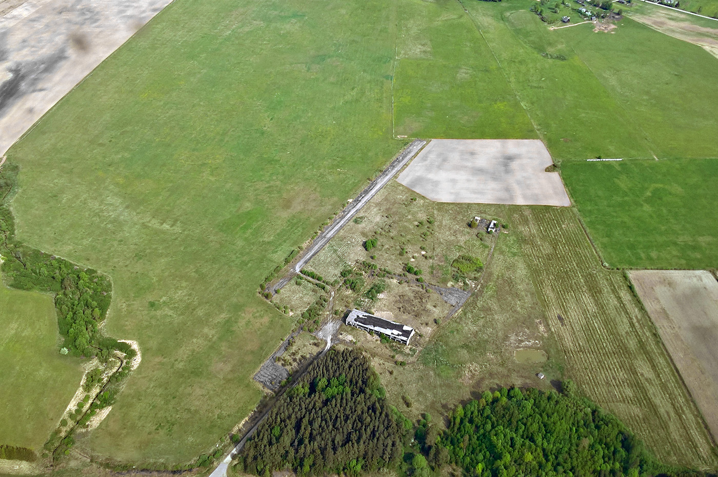
Former agricultural airfield in a quite poor condition. There are many bushes along the runway and there is growing grass and misc obstacles on the runway. Usable for emergency only.

Effectivity: 2016-09-03

Location: 17 km SW of Ape town, 5 km SSE of Gaujiena village
Get Directions →

+Details

Status: Uncertified

Condition: Bad

Ownership: Unknown

+Runway

Direction: 18/36

Dimensions: 400x20m

Surface: Asphalt

Elevation: 86m / 282ft

+Obstacles

Approach: Road and trees 240m from THR RWY36.

Airfield: Bushes along the RWY W side. Bushes/trees at both ends of the RWY.

+Other

Radio frequency: 123.95 MHz

Fuel availability: NIL

+Gallery
+Meta

Posted: July 13, 2013

Author:

Category: Airfields, Usable airfields

+Comments

Leave a Reply